Mirador Morro de Toix - best viewpoint on the Costa Blanca? - nearby hike in the mountains
- Admin
- Nov 8, 2025
- 3 min read
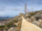
Morro de Toix is the extreme tip of the Sierra Bernia mountain range where it flows into the Mediterranean Sea between Altea and Calpe. From the Mirador Morro de Toix you can see much of the northern Costa Blanca. It only takes 10 minutes to walk up there, and from there a bird watching route leads on a 1.4 km long hiking trail up to a mast station.

Morro de Toix separates the Marina Alta area from the Marina Baixa. On one side is Calpe, on the other is Altea. From the Mirador de Morro you have a view of both these areas. If you look to the north-east, you can see the Oltá mountain on the left and the Calpe cliff on the right with Calpe and Bahía de Calpe in between. Straight ahead you can see all the way to the nature reserve El Montgó, which is located between the coastal towns of Xàbia (Javea) and Dénia, right on the border with the Valencia region. On days with clear visibility, you can also see the Ibiza islands.


Looking south-west, you see the Serra Gelada (Sierra Helada) at one end and Altea with the Bay of Altea in between. Benidorm's skyscrapers look up next to Serra Gelada. Straight ahead, you see the iconic mountain Puig Campana with its notch on top. You can also see the Sierra de Ponoig - popularly known as the Lion Mountain - and several mountains within.


From Mirador Morro de Toix, the cliff wall drops 200 meters straight into the sea. It is inaccessible to anyone but mountain climbers and is therefore a good place for birds to live. This is also one of the reasons why there is an ornithological route along the cliff wall to a mast station. Wildflowers and wild herbs grow along the roadside.


More excursions: www.turideer.com
Excursion of the week: Mirador Morro de Toix viewpoint - the best viewpoint on the Costa Blanca?
Suitable for: Anyone in normal physical condition. It is a steep 400 meter hill that can be difficult to walk. The ornithological route at the top is easy to walk.
Length: The route is 1.4 km long. It takes about 10 minutes to walk the steep hill up to the Mirador Morro de Toix and then about 20 minutes to walk the ornithological route to the mast station.
Getting there: Type Mirador Morro de Toix into Google Maps. Alternatively: Take the N-332 from Altea towards Calpe. Turn right at Urbanización Maryvilla. Then follow the signs for Mirador Morro Toix on a steep road that winds up the cliff side. On the way down, there is a sign for the N-332. Park along the road just by the roadblock to the hiking trail where the steep hill begins.
