
Planes, charming mountain village in the Alicante province - what to see in Planes?
- Admin

- Mar 13
- 8 min read
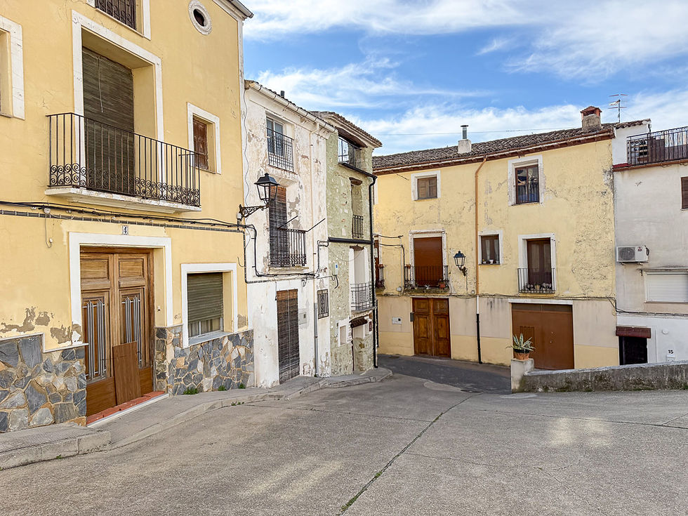
Planes is a small mountain village in the northern part of the Alicante region, surrounded by mountains, valleys and the Serpis River. The houses are located along the sides of a cliff with a medieval castle on top. The streets run in a ring around the cliff and are connected to each other by stairs and steep cross streets. Here you get an unvarnished picture of daily life in old Spain. Some of the buildings are painted brick houses, while others are unworked stone houses from the Middle Ages. This article describes what you can see in Planes and the surrounding areas.

In recent years, Planes has become a bit more touristy, but the village still has an authentic feel. It has just over 700 inhabitants (705 in 2025), and the houses are concentrated in a small area. So you can see a lot just by walking around the streets and looking around. But here is a list of the most important things you can see:
Before you get to the village
Attractions
Ermita de Santo Cristo
Cruces de Término
Barranco de La Encantada
Albufera de Gaianes
Before you get to the village
The people of Planes have traditionally lived from agriculture, with cherries, olive oil and almonds as the main products. Before driving into Planes, you should take a look at some of the cherry fields, which during the flowering season (February/March) give the landscape a beautiful pink color. At the entrance you will also find a peculiar construction with a cross in the middle, called El Término.


Attractions
Despite its modest size, Planes has three restaurants, one bar and two hotels. The most important buildings are the Iglesia de Santa María, the town hall (ayuntamiento) with the Reloj de Sol sculpture and the Castillo de Planes. You should also visit El Parque de Porxet and the Font Nova spring with its aqueduct and medieval bridge.


Ermita de Santo Cristo
The clifftop on which the Ermita de Santo Cristo is located is called Sierra de Sant Cristòfol. It is located right next to the village on the northeast side. To get there, you walk past the Font Nova spring and across the river. The path to the chapel turns off the road after a few hundred meters. This is also the path you should follow if you want to go to Barranco de la Encantada. The route up to the chapel is 1 km long and has a difference in altitude of 80 meters. It takes 20-30 minutes with breaks to admire the view.


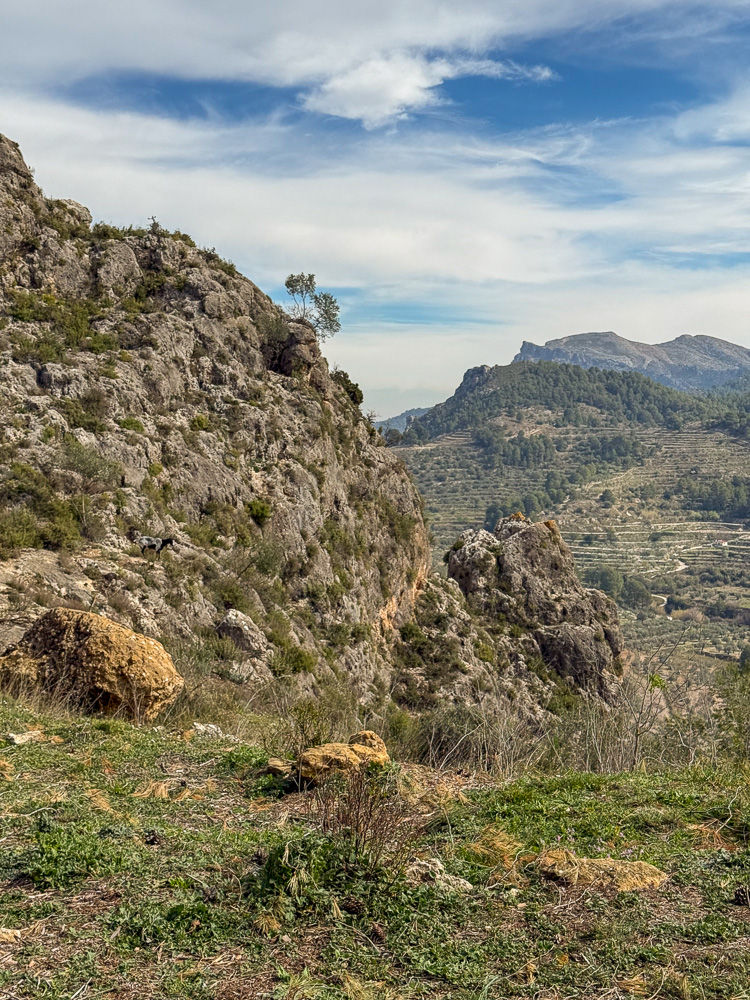


Barranco de La Encantada
Barranco de la Encantada means the enchanted or bewitched ravine. According to folklore, there is a bewitched young Moorish woman there who appears on Midsummer Eve near water. The river Serpis flows at the bottom of the ravine. Barranco de la Encantada is located near Planes, and it is possible to walk to it from the village. You start at Font Nova, go up to the Ermita de Santo Cristo and continue on the road that goes down to the left of the chapel. The route is 3.5 km each way, and it is estimated that you will spend 3-4 hours on the walk in total. It is also possible to drive there, and that is the route described below. The most famous place in the ravine is Gorg del Salt. There is a small waterfall with a pool below.

To get to Barranc del Salt, take the CV-700 out of town on the east side towards Vall de Gallinera. After 10 km - an 8-minute drive - you will come to an exit on the left with a sign for Barranco de la Encantada. Previously, it was possible to drive all the way down to Gorg del Salt, but now you have to park just off the exit in a parking lot on the right side of the road. It takes about 10-15 minutes to walk from the parking lot to Gorg del Salt.


Albufera de Gaianes
Albufera de Gaianes is located 15-20 minutes drive from Planes and is one of the recommended excursion destinations in the area. It is a small freshwater lagoon and a nature reserve that, during periods of good water flow, is an idyllic place with a rich birdlife. However, due to a long drought and a lot of water withdrawal for agriculture in the area, the lagoon is now completely dry in 2026. There is therefore also little bird and animal life there, but the lagoon could become wetland again if there were to be longer periods of heavy rain.
To get to Albufera de Gaianes, you drive to Gaianes and continue along a narrow asphalt road for a few kilometers until you reach a small airport for model aircraft on the right. The nature reserve is on the left side of the road next to this. It is only a couple of hundred meters from the road to a viewpoint, and you start at a sign that shows the way to Mirador de la Mota. There is no marked parking lot, but an area along the road on the left side close to the airport can be used. Enter Albufera de Gaianes in Google Maps and you will go directly to the place where the trail begins.


More excursions: www.turideer.com
This week's excursion: Exploring what to see in Planes, a small mountain village in the northwest of the Alicante province.
Getting there: Take the A7 from Alicante to Alcoy. Continue a few kilometres past Alcoy, then take the exit for Muro de Alcoy onto the CV-700. Continue straight ahead on the CV-700 through Benimarfull and on until you reach Planes. Alternatively: Type Planes into Google Maps. Park on the outskirts of the village, preferably at the first exit on the right after the junction with El Término on Carrer Metge Rodrigo. From there, there are steps down to the village. It is very difficult to find a free parking space inside the village.


Comments