top of page

Els Arcs by Castell de Castells - hiking in the mountains to a fascinating natural phenomenon

  • Writer: Admin
    Admin
  • Oct 4
  • 4 min read

A few kilometers from the village of Castell del Castells, an hour's drive inland from the Costa Blanca near Benidorm, lies a natural park with double arches in the mountains. Here, heavy rains and winds over millennia have carved out caves and cavities that in some places have created beautiful arches. There are many routes to Els Arcs. The easiest and quickest is a 45-minute hike.


Doble buer i fjellet ved i Naturparken Els Arcs de Castell de Castells i Alicanteregionen

The hike starts at a small parking lot on the road between Tarbena and Castell de Castells (CV-752). About 8 km from Tarbena, there is a small dirt road up to the left. There is an information sign with information about the nature park and the route to the double arches Els Arcs de Castells. You can park on the shoulder of the road by the sign or on the other side of the CV-752. From this point, it takes about 45 minutes to walk to the arches. If you want to shorten the route for health or other reasons, you can drive up the dirt road and follow the signs to Els Arcs and park in a small parking lot further up.

Parkeringsplass ved Naturparken Els Arcs de Castell de Castells i Alicanteregionen

However, this post describes a round trip that takes you back to the parking lot at CV-752, and then there is no advantage to parking further up. We start at point 1 on the map below and go to point 3 via point 2 (which we do not go up to). The double arches are located at point 3. From point 3 we go to point 4 which is a viewpoint from the top called Penya Escoda where you have a view of several arches in the mountain. From point 4 we go back to CV-752 and point 1 where the car is parked. The entire trip with the detour down to Penya Escoda is about 6 km and takes about two hours to walk without breaks. If you do not take the detour down to point 4, you save 1 km and half an hour of walking.


Kart til Naturparken Els Arcs de Castell de Castells i Alicanteregionen

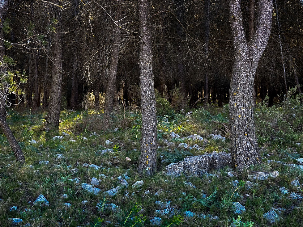
When you walk from the parking lot, you quickly get a view of the mountainous area we are going to walk in. On the left side there is a pine forest, on the right-hand side plains.


Kvinne går på grusvei i Naturparken Els Arcs de Castell de Castells i Alicanteregionen

Pinjeskog i Naturparken Els Arcs de Castell de Castells i Alicanteregionen

Fjell i Naturparken Els Arcs de Castell de Castells i Alicanteregionen

Dal i Naturparken Els Arcs de Castell de Castells i Alicanteregionen

After reaching the top of the hill, a lush valley opens. We will go down to the bottom of the valley and then turn right up towards the mountain. Follow the signs for Els Arcs.


Informasjonsskilt i Naturparken Els Arcs de Castell de Castells i Alicanteregionen

Parkeringsplass ved veien i Naturparken Els Arcs de Castell de Castells i Alicanteregionen
Parking lot by the road a few hundred meters up the slopes towards the mountain. You can park here if you just want to walk up to Els Arcs and back again the same way.

Vei opp til de doble buene i Naturparken Els Arcs de Castell de Castells i Alicanteregionen

Lysegrå kalkstein i fjell i Naturparken Els Arcs de Castell de Castells i Alicanteregionen

Kvinne ved veikryss i Naturparken Els Arcs de Castell de Castells i Alicanteregionen
Where the asphalt ends, we turn right and continue walking on a gravel road. There is a sign for Els Arcs.

Kvinne på grusvei ved olivenlund i Naturparken Els Arcs de Castell de Castells i Alicanteregionen

Blomster i veikanten med kvinne i bakgrunnen i Naturparken Els Arcs de Castell de Castells i Alicanteregionen

Veiskilt til de doble buene Naturparken Els Arcs de Castell de Castells i Alicanteregionen
When there are 654 meters left to go to the double arches, there is a path to the left that we will follow up to the arches and back again the same way. Here the gravel road turns into a path.

Sti i Naturparken Els Arcs de Castell de Castells i Alicanteregionen

Fjellandskap i Naturparken Els Arcs de Castell de Castells i Alicanteregionen

Panorama til fjell i Naturparken Els Arcs de Castell de Castells i Alicanteregionen

Nærbilde av bart fjell i Naturparken Els Arcs de Castell de Castells i Alicanteregionen

Smal sti i Naturparken Els Arcs de Castell de Castells i Alicanteregionen
At this point, which is marked with two yellow dots on the stone, we will take the narrow path up to the left. If you follow the path straight ahead, you will go too far down into the terrain. After a couple of hundred meters, you will come up to the arches.

To store buer i kalkfjell i Naturparken Els Arcs de Castell de Castells i Alicanteregionen

The path stops at the double arches of Els Arcs. Here there is information in Spanish about why this natural phenomenon has occurred. The rock in this area consists of two types of limestone, a light gray, and a dark gray. The light gray rock is softer than the darker variety and is therefore less affected by erosion. Over hundreds of thousands of years, the combination of heavy rains and intense winds with sand particles has managed to wash away part of the light gray, soft limestone, so that cavities have formed in the rock. In some places, this has created arches of the type seen in these pictures.


Nærbilde av de to buene i Naturparken Els Arcs de Castell de Castells i Alicanteregionen

Hule ved de to buene i Naturparken Els Arcs de Castell de Castells i Alicanteregionen
In addition to the arches, there is also a small cave at one end. You can go down to the arches, but not through and beyond.

Utsikt til slake fjell i Naturparken Els Arcs de Castell de Castells i Alicanteregionen
On the way back down, you get a view of the part of the mountain area that you had behind you on the way up and therefore perhaps didn't notice very well.

Blå og hvite markblomster i veikanten i Naturparken Els Arcs de Castell de Castells i Alicanteregionen

Sti gjennom buskas i Naturparken Els Arcs de Castell de Castells i Alicanteregionen

Veiskilter i Naturparken Els Arcs de Castell de Castells i Alicanteregionen
At the bottom of the sign we will turn left towards Penya Escoda. Follow the gravel road to the next sign.

Grusvei forbi gammel finca i Naturparken Els Arcs de Castell de Castells i Alicanteregionen

Hvite markblomster i Naturparken Els Arcs de Castell de Castells i Alicanteregionen

Berg med lys kalkstein i Naturparken Els Arcs de Castell de Castells i Alicanteregionen

Terrassert jordbruk i Naturparken Els Arcs de Castell de Castells i Alicanteregionen

Veiskilter i Naturparken Els Arcs de Castell de Castells i Alicanteregionen
At this sign you can choose to go down to Penya Escoda and back again the same way or go directly back to the parking lot by following the sign towards Pla D'Alalt.

Grusvei som slynger seg ned dal med høye fjell på siden i Naturparken Els Arcs de Castell de Castells i Alicanteregionen

On the way down to Penya Escoda you get an overview of the valley down to Castell de Castells. After 500 meters you come to a viewpoint with an information sign about Penya Escoda. From there you go back the same way.


Dal med grusvei og asfaltert vei med fjell i bakgrunnen i Naturparken Els Arcs de Castell de Castells i Alicanteregionen

Informasjonsplakat ved fjell i Naturparken Els Arcs de Castell de Castells i Alicanteregionen

Kvinne legger stein på varde i Naturparken Els Arcs de Castell de Castells i Alicanteregionen

After walking the same way back up the hill, turn left at the sign and follow the direction towards Pla D'Alalt. Here you walk through cultural landscapes with views of the surrounding mountains. After a brief time, you will see the parking lot down on the right.


Gjengrodd grusvei i Naturparken Els Arcs de Castell de Castells i Alicanteregionen

Hvite blomstrende trær i Naturparken Els Arcs de Castell de Castells i Alicanteregionen

Mandeltreblomstring i Naturparken Els Arcs de Castell de Castells i Alicanteregionen

More excursions: www.turideer.com


Excursion of the week: The double arches Els Arcs de Castell de Castells - a hike in the mountains to a fascinating natural phenomenon.


Length: Approx. 6 km if you take the walk past Penya Escoba, otherwise 5 km. If you are in good physical shape, it will take you 45 minutes to walk to the arches and approx. 2 hours for the entire walk including Penya Escoba.


Suitable for: Anyone in normal physical condition. It is an easy hike with no dangerous sections, but there is some climbing up to Els Arcs which can be strenuous if you are elderly or have health issues. However, if you adjust your pace to your fitness level and take breaks along the way, most people will be able to complete this hike.


Geting there: Enter "Ruta als Arcs de Castells" in Google Maps. This will take you straight to the car park. Alternatively: Drive from Benidorm/Altea towards La Nucía, then via Polop and Callosa d'en Sarrià towards Tàrbena. After Tàrbena, turn left onto road CV-752 towards Castell de Castells. It is approx. 8 km. from Tàrbena to the car park, approx. 12 minutes' drive.


© 2016 by Liv and Geir Stene-Larsen.

  • Facebook
  • Instagram
bottom of page