top of page

Old Oslo - the medieval park and church ruins in Oslo - four churches and a monastery - new districts and old wooden houses

Writer: Admin
Admin
13 minutes ago
8 min read

Bjørvika, Bispevika and Sørenga are among the newest urban areas in the center of Oslo. Just a few decades ago, these were heavily trafficked road and harbor areas. Today, the Opera, MUNCH, Deichman, new residential districts, parks, bathing areas and a continuous modern harbor promenade are located here. But right behind this new city profile lie remains from a thousand years ago. In the Medieval Park, an attempt is made to recreate the original shoreline and city profile. Behind there, in turn, lie the districts of Gamlebyen, Vålerenga and Kampen - the first districts that arose around the original center of Oslo.


Pitorresk smal gate med gamle rekkehus og blomster på Kampen i Gamle Oslo

Many tourists visiting Oslo for the first time may only see the area around Carl Johans gate and Aker brygge and what is today the main center of Oslo with the Palace, the Storting, the National Theater and the central shopping streets. Those who have done a little research in advance may also see the Opera, MUNCH, Deichman and the buildings in the Barkode area. But not many make the trip to the area behind the new city profile where the Medieval Park and nearly a thousand-year-old ruins testify to the time when this was where Oslo's center was located. This article describes a tour of these historical areas and the early districts in Oslo's history: Gamlebyen, Vålerenga and Kampen.

Dagens byprofil i området rundt Bjørvika og Sørenga i Oslo
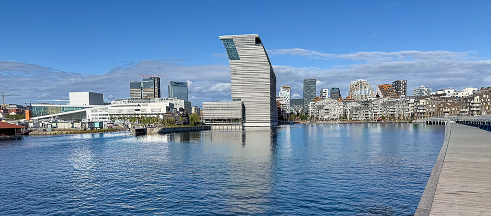
The new city profile with the Opera House on the left, the MUNCH Museum (Lambda) in the middle and the modern buildings in Bjørvika with the row of high-rise buildings in Barcode behind.

Rekke med høyhus i forskjellige urforminger ved Barcode i Oslo sentrum
The Medieval Park was opened in 2000 (bottom right in the picture). It consists of a grassy park with an artificial lake that shows where the coastline was in the Middle Ages when the center of Oslo was located here. On the hillside is the row of high-rise buildings referred to as Barcode. Since this picture was taken, several large buildings have been erected, such as the Opera House, the MUNCH Museum and housing, which largely obscure the forward-looking urban profile that Barcode once represented.

Havnepromenade med moderne bygg ved siden av med uterestauranter ved Sørenga i Oslo sentrum
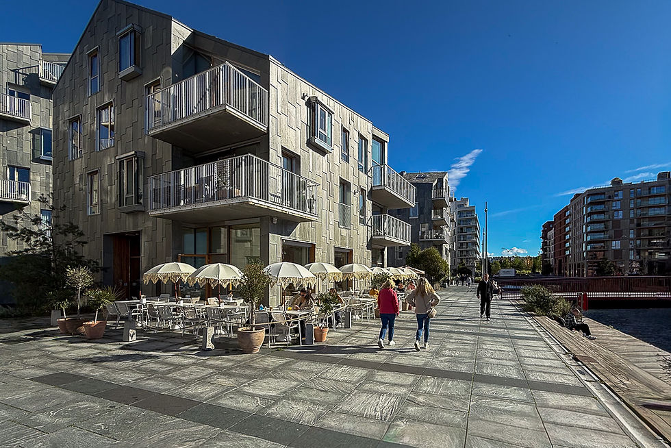
The residential areas around Sørenga, Bjørvika, Lohavn and Bispevika are built on fill materials that have been laid out in the harbour basin. The buildings stand on piles and concrete elements that are founded on solid ground under the original sea sediments. This was previously a large container port. In the Fjordbyen project, a long continuous harbour promenade has been created where there are a number of outdoor restaurants in the ground plan of residential buildings. At the far end of Sørenga, bathing areas with sandy beaches and bathing jetties have been created.

Kanal med vann og trapper ned til vannet fra bygninger på sidene ved Sørenga i Oslo sentrum
Since the residential areas in the old container port are built on piles out in the old harbor basin, it has also been possible to create canals between some of the rows of houses. Boats can be driven in the canals, and in some places the owners can have the boat parked outside the house.

Kanal med vann og brygge med et fosseutløp som senere skal bli utløpet fra Alnaelva i Oslo
The Alna River will flow into this canal when the new river course through the Medieval Park is opened.

Benk og sykkel foran vannspeil i forkant av høyhus ved Middelalderparken i Oslo sentrum
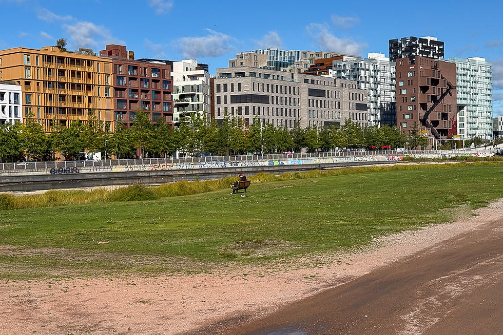
The medieval park consists of an artificial shallow pond and a large grassy area. It is located on the site of the quay in the Middle Ages and shows where the coastline used to be. Nearby are St. Mary's Church and Kongsgården. On nice days in the summer, the park is very popular.

Laftede tømmerhytter i Middelalderparken i Oslo sentrum
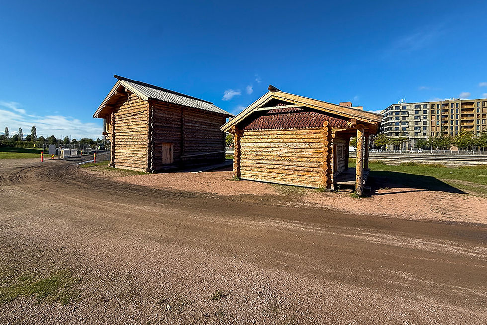
Facing the water are two slatted log cabins. They are a reconstruction of buildings as they looked and were made in the Middle Ages. More log cabins will be added in the future to try to recreate something of the early medieval town. The construction work is also used to train in the craft methods used at the time.

Husrad på andre siden av vannspeilet i Middelalderparken i Oslo
When you sit on the shore of the water mirror in the Medieval Park, you no longer look out over the fjord, but a row of modern buildings on the other side of the road.

Informasjonsplakat under trekroner ved kirkeruinene ved Middelalderparken i Oslo
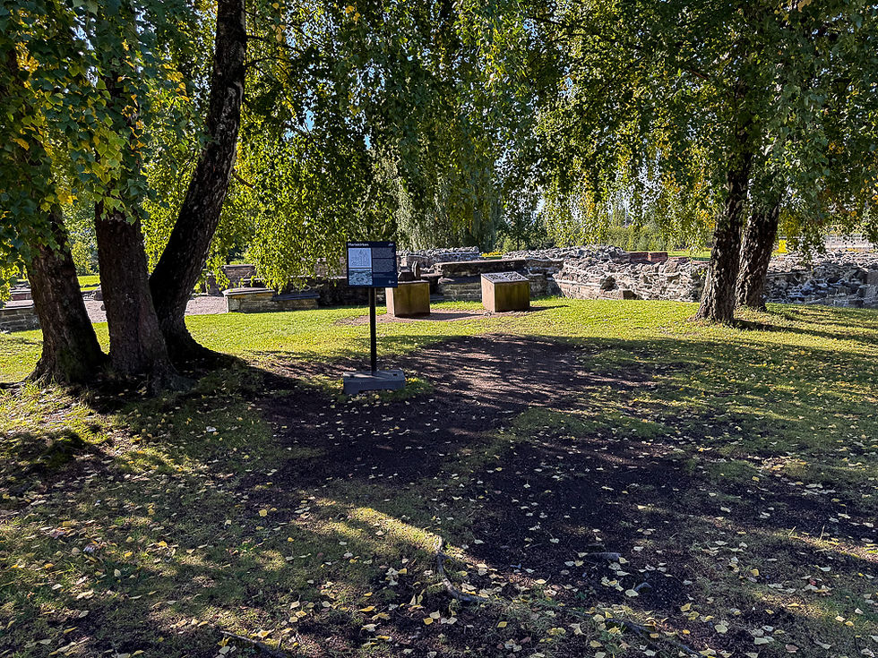
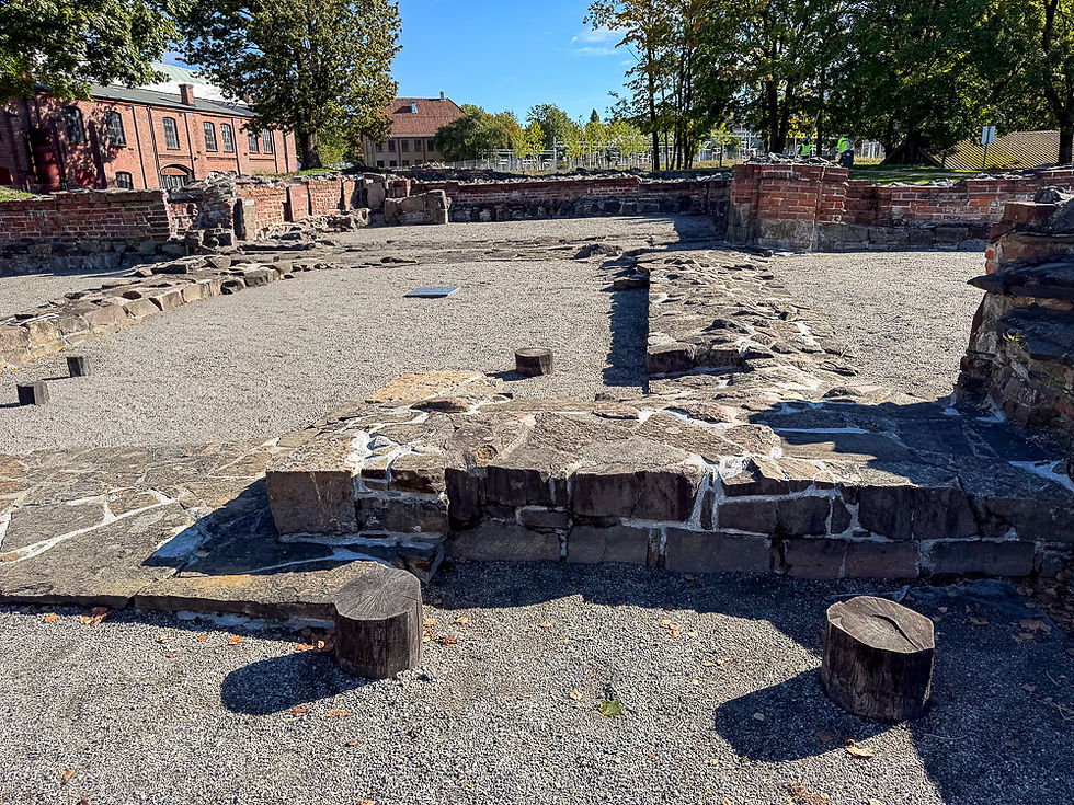
Right next to the Medieval Park are the ruins of St. Mary's Church. It was built in 1050 as a wooden church. In the early 12th century, it was replaced by a stone church. St. Mary's Church is the church in medieval Oslo that was closest to the shoreline. It was the king's church. It was dedicated to the Virgin Mary and was a prestigious building for the monarchy. It was a royal chapel and funeral church for several Norwegian queens.

Modell av Mariakirken ved ruinene etter Mariakirken i Oslo
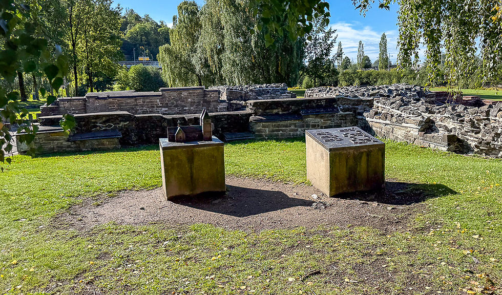
Next to the ruins you will find a model that shows what the church is believed to have looked like in its time.

Ruiner etter gammel trekirke og litt nyere steinkirke fra Middelalderen Mariakirken i Oslo
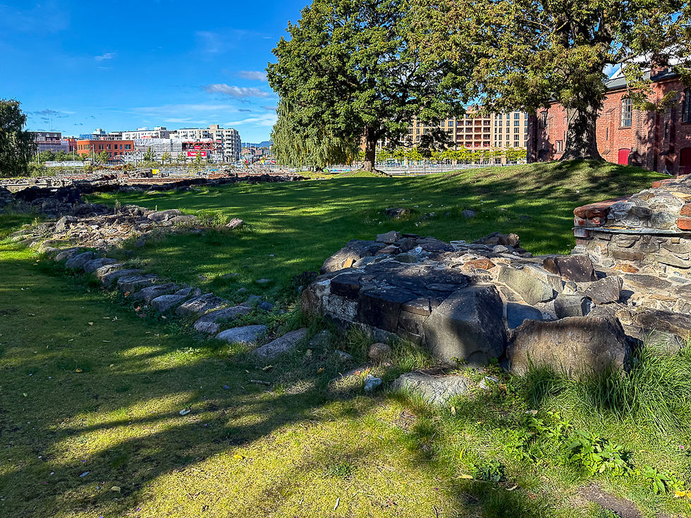
The cut-off wooden pillars show where the foundation of the wooden church from 1050 stood. The stone walls show the foundation of the stone church that was built in the early 12th century.

Opprinnelig steinmur ved Mariakirken i Oslo
Original stone wall from the 12th century

Steinhelle over Kong Håkon den 5. grav ved kirkeruinene i Oslo
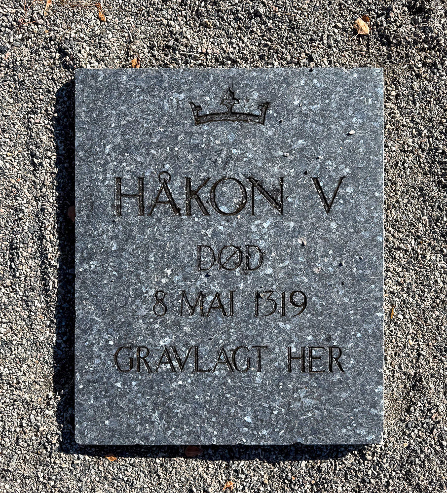
Håkon V is buried under this stone slab in the ruins of St. Mary's Church. Håkon was the son of King Magnus Lagabøte. When he took over the throne in 1299, he moved the seat of the kingdom from Bergen to Oslo. By giving the rector of St. Mary's Church the royal seal in perpetuity, he also made Oslo the capital of the Norwegian Empire. He is, however, best known as the builder of fortresses. He had Akershus Fortress, Vardøhus Fortress and Båhus Fortress built. He also strengthened the position of the monarchy and the administration of the country. He was married to Queen Eufemia, who brought with her her library, which is said to have been one of the most extensive in Europe. She was known for her cultural interest and introduced both a court life and a knightly culture to Håkon's Hall in Oslo. She also contributed to cultivating continental culture at the Nordic courts. Both she and her father are buried in St. Mary's Church.

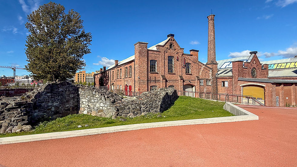
Ruiner etter Mariakirken og nedlagte jernbanebygg i rød tegl i Oslo
The ruins of St. Mary's Church are located next to a block of disused red brick railway buildings.

Kunstig anlagt elveløp for Alnaelva i Oslo
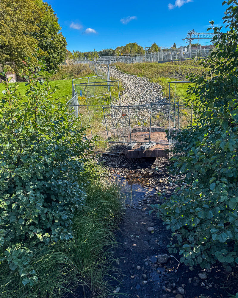
At the south end of the ruins is an artificially created river course that will direct the flow of the Alna River into the Medieval Park's dam when the work is complete.

Planlagt nytt utløp for Alnaelva i vanndammen i Middelalderparken i Oslo sentrum
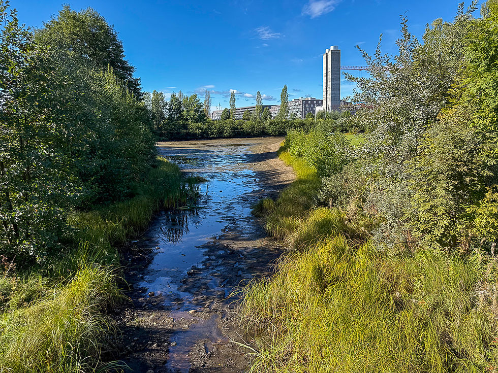
The picture shows the future inlet of the Alna River into the pond in the Medieval Park. By giving the artificial pond an inlet and an outlet, the flow of fresh water will lead to better water quality for both birds and bathers.

Buer i forskjellige utforminger i teglstein ved Middelalderparken og kirkeruinene ved Middelalderparken i Oslo
In September 2021, a traditional craft course was organized that resulted in these arch structures right next to the ruins of St. Mary's Church. The participants learned traditional bricklaying and made, among other things, a Romanesque arch, a pointed arch and a Gothic pointed arch, as well as a natural stone vault. The structure will remain as a representation of the craftsmanship of earlier times.

Ruiner etter Kongsgården ved kirkeruinene ved Middelalderparken i Oslo
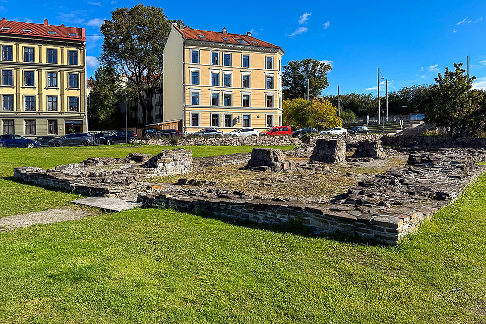
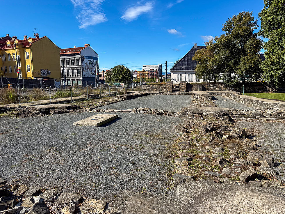
Just inside the ruins of the Mariakirken are the ruins of Kongsgården. Until the 13th century, Kongens gården was a timber and earth castle. In the 13th century, the King replaced this with a stone castle with a ring wall. You can see the ground plan of a large two-story hall building that was probably quite similar to Håkonshallen in Bergen.

Nedlagte jernbanebygninger ved kirkeruinene ved Middelalderparken i Oslo
In the picture above you can see the ruins of Kongsgården on the left and red brick buildings behind the Gamlebyen train station. When the route of this railway was rerouted, the buildings became redundant. The railway track was built in a tunnel and the area above was incorporated into the Medieval Park. It is still unclear what these old buildings will be used for, but several of the buildings are highly worthy of preservation.

Nedlagte jernbanebygninger i rød teglstein med turvei med rød grus foran ved Middelalderparken i Oslo
There are trails around the area where you can walk, jog or cycle.

Ruiner etter Clemenskirken ved kirkeruinene ved Middelalderparken i Oslo
A few hundred meters further inland you come to the ruins of the Clemens Church. The Clemens Churchyard is one of Norway's oldest cemeteries, much older than the battle of Stiklestad. The Clemens Church was built in the year 1050 by Harald Hårdråde. It was a cemetery for the inhabitants of the oldest Oslo.

Åpen plass Oslo Torg med husfasade med veggmaleri i bakgrunnen i Oslo sentrum
The next attraction you come to is Oslo Torg. In the Middle Ages, all the roads from Eastern Norway met at this place in the Old Town. The square became a hub for trade with the interior and goods from abroad. Today, the space is used for some cultural events. It is located right next to Ladegården and Bispealmenningen.

Lav hvit murbygning Ladegården i Oslo
Across the street from Oslo Torg is Oslo Ladegård. It was a farm whose task was to supply Kongsgården with food.

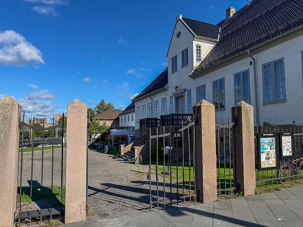
Inngangspartiet til Oslo Ladegård og rester etter Bispeborgen ved Middelalderparken i Oslo
The barn was built in 1725 on the remains of the eastern wing of the Bishop's Castle. In the 13th century, the bishop's castle was converted from a wooden farm to a stone castle with walls and towers. The bishop had direct access to Halvard Church via a passageway several meters above ground. He also had access to his own pier with trade goods from home and abroad. The southern meadow below the bishop's castle went all the way down to the shoreline and has given its name to the area that is today called Sørenga.

Restaurert del av hage med lave formklippede hekker og hellelagte gangveier etter mønster fra Middelalderen i Oslo
On the sea side of the Ladegården building, the garden is being reconstructed as it was in the Middle Ages.

Inngang gjennom steinmur med jernporter til kirkeruiner etter Hallvardskatedralen i Oslo
On the other side of the road at Ladegården is the entrance to Hallvard Cathedral also known as Hallvardskirken or Oslo Cathedral. It was built by Sigurd Jorsalfare who is buried here and who is best known for his crusade to Jerusalem. At that time Jerusalem was called Jorsal, and King Sigurd was therefore called Jorsalfare (the one who goes to Jorsal).
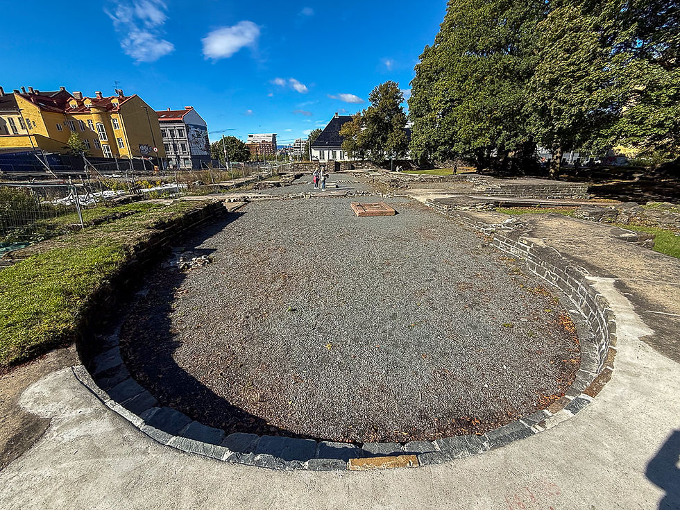
Halvsirkelformede ruiner etter Hallvardskatedralen i Oslo

Ruiner etter grunnmur fra Hallvardskatedralen i Oslo
The ruins of St. Hallvard Cathedral

Ruiner etter Olavsklosteret i Oslo
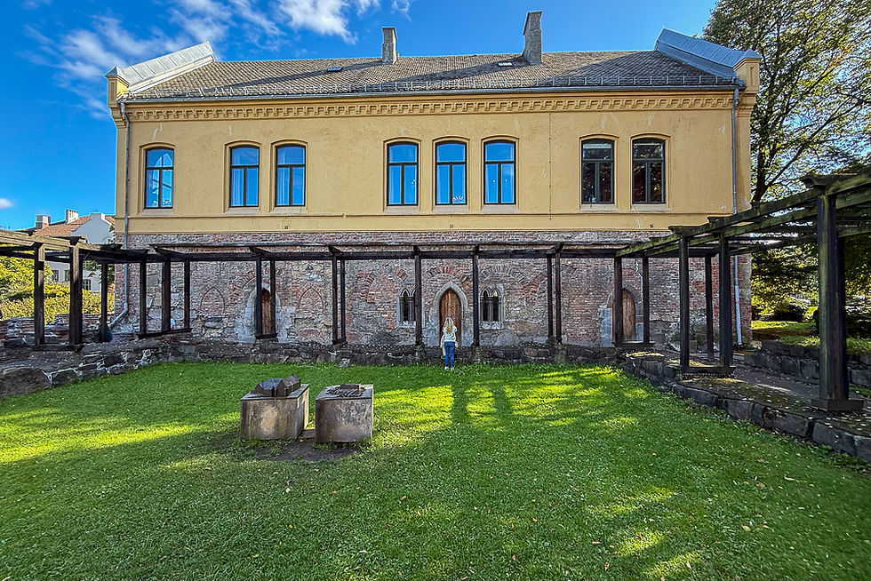
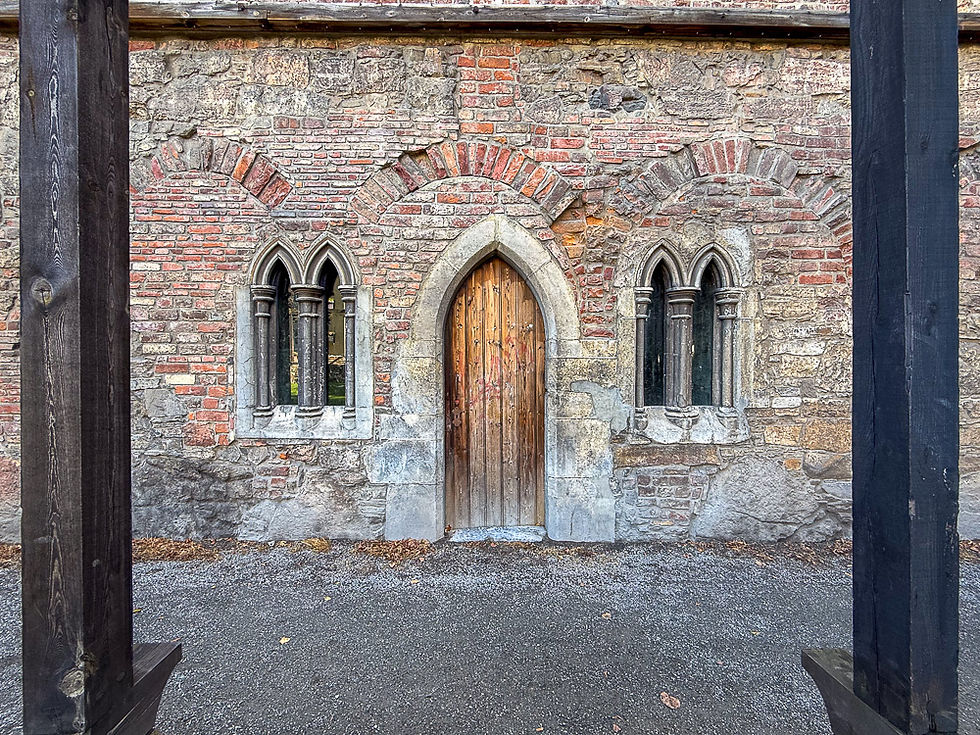
Right next to St. Hallvard Cathedral is the Dominican monastery complex called Olavsklosteret. It had four wings with a large monastery garden in the middle. The first floor of the east wing is intact. Oslo Bishop's Palace was built on top of the former east wing of the monastery in 1883-1884.

Modell av Olavsklosteret i Oslo
Model of St. Olav's Monastery

Rester etter Olavsklosteret med Oslo Bispegård på toppen i bakgrunnen
Oslo Bishop's Palace with the preserved first floor and the monastery garden in front

Inngangsparti med portalformede vinduer og dør til Olavsklosteret fra Middelalderen i Oslo

Store gule murbygg med portalformede vinduer og kirkespir ved Oslo Bispegård i Oslo
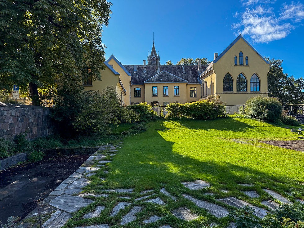
Oslo Bishop's Palace

When you pass Bispegården you enter the old districts of Vålerenga, Gamlebyen and Kampen. Here some of the old buildings from the time when these were areas where the original city grew have been preserved. Oslo does not have a continuous Gamleby like many other cities have, but in these districts you can see pieces of the original. Below are some environmental pictures from Vålerenga and Kampen.
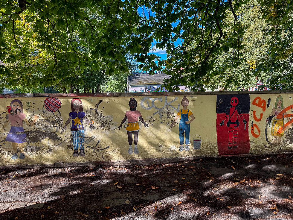
Gul mur med veggmaleri av lekende barn i Oslo

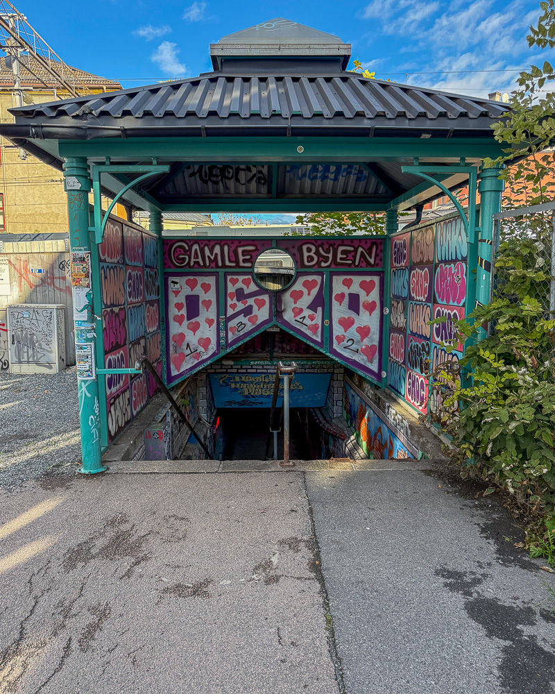
Gammel overbygg til nedgang til fotgjengerundergang til Gamlebyen i Oslo dekorert med røde hjerter
Pedestrian underpass to the Old Town district

Veggmaleri på murvegg i fotgjengerundergang i Gamlebyen i Oslo

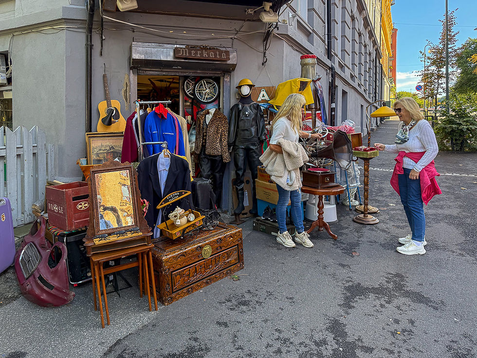
To kvinner foran gamle gjenstander utstilt utenfor bruktbutikk i Vålerenga i Oslo
Second-hand shop in Vålerenga

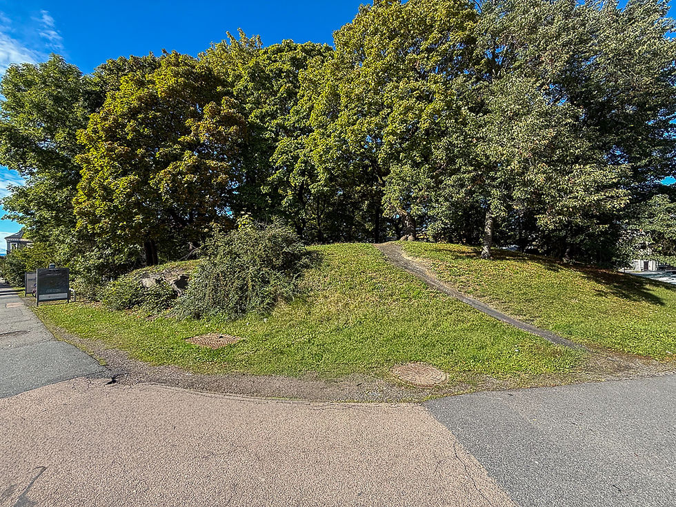
Liten jordtopp med store grønne trær kalt Galgeberg i Oslo
The picture shows the so-called Galgeberg. In the Middle Ages from the 12th century until 1815, this was the city's place of execution. On this small hill there was once a gallows on which criminals were hanged, hence the name Galgeberg. Executions also took place using the steeple and wheel and later beheading. On October 14, 1815, Anders Flatebydalen was executed by beheading by executioner Anton Lædel as punishment for killing the servant boy Gunder Gjestang. The head was later placed on the stake. It was the last execution to be carried out on Galgeberg. The place of execution and the executions were then moved to Etterstadsletta.

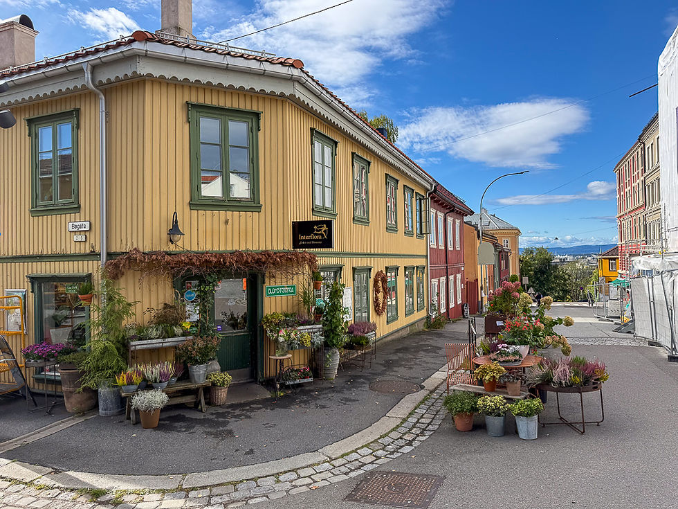
Hushjørne med gult trehus med mange blomster foran i Vålerenga i Oslo

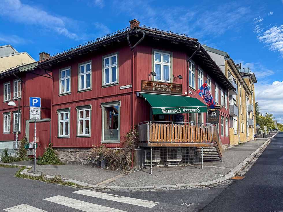
Hushjørne med rødmalt trehus Vålerenga Vertshus i Oslo
Vålerenga Vertshus is a gathering place for football fans of Vålerenga football club.

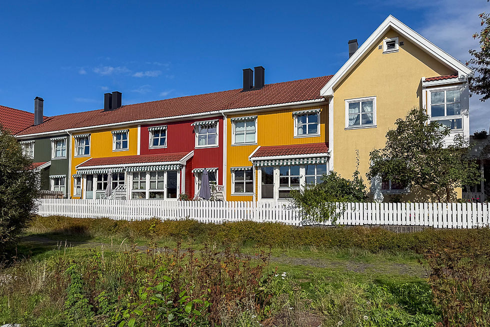
Trehus i rekke malt i ulike farger i Vålerenga i Oslo
Old wooden house complex in Vålerenga

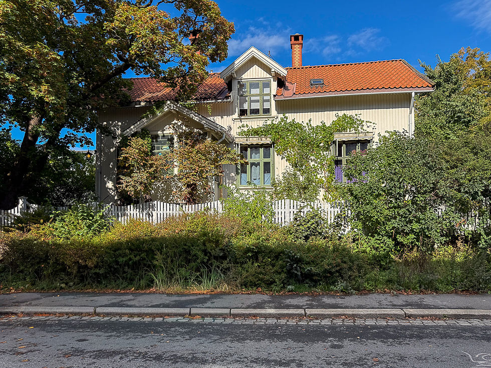
Gammelt stort hvitt trehus med grønmne vinduslister gjengrodd av eføy og busker i Vålerenga i Oslo

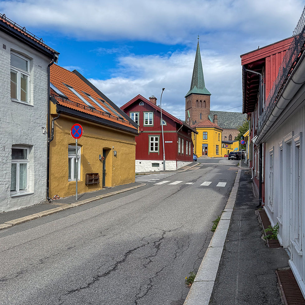
Bygate med gammel bebyggelse og kirke med grønt spir i Kampen i Oslo
Street in the Kampen district with Kampen church in the background

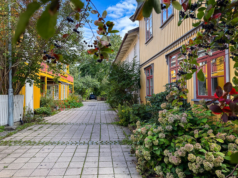
Pittoresk smal gate med gamle trehus påsidene og mange blomster og busker langs veggene i Kampen i Oslo
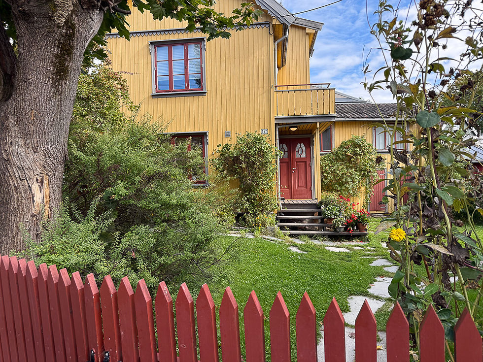
The characteristic old wooden houses in the Kampen district

Blomsterbed med store grønne blader og røde blomster foran gammelt gulmalt trehus i Kampen i Oslo

Pittoresk hage med gult trehus og rødt stakitt i forkant i Kampen i Oslo

When you pass Kampen on your way back to Oslo city center and the Medieval Park, you first come to Klosterenga Park where the Hovindbekken stream has been excavated. A little further down you come to the prison Oslo Botsfengsel.
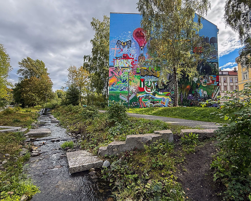
Liten bekk Hovindbekken med fasade med veggmaleri ved siden av  i Oslo

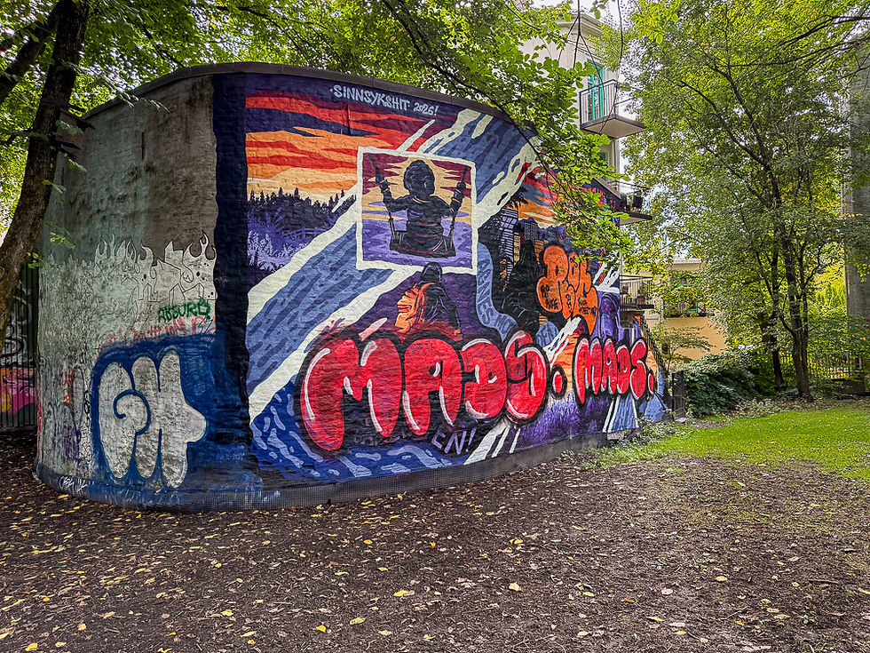
Fargerikt veggmaleri på murbod i Oslo i nærheten av Oslo Botsfengsel

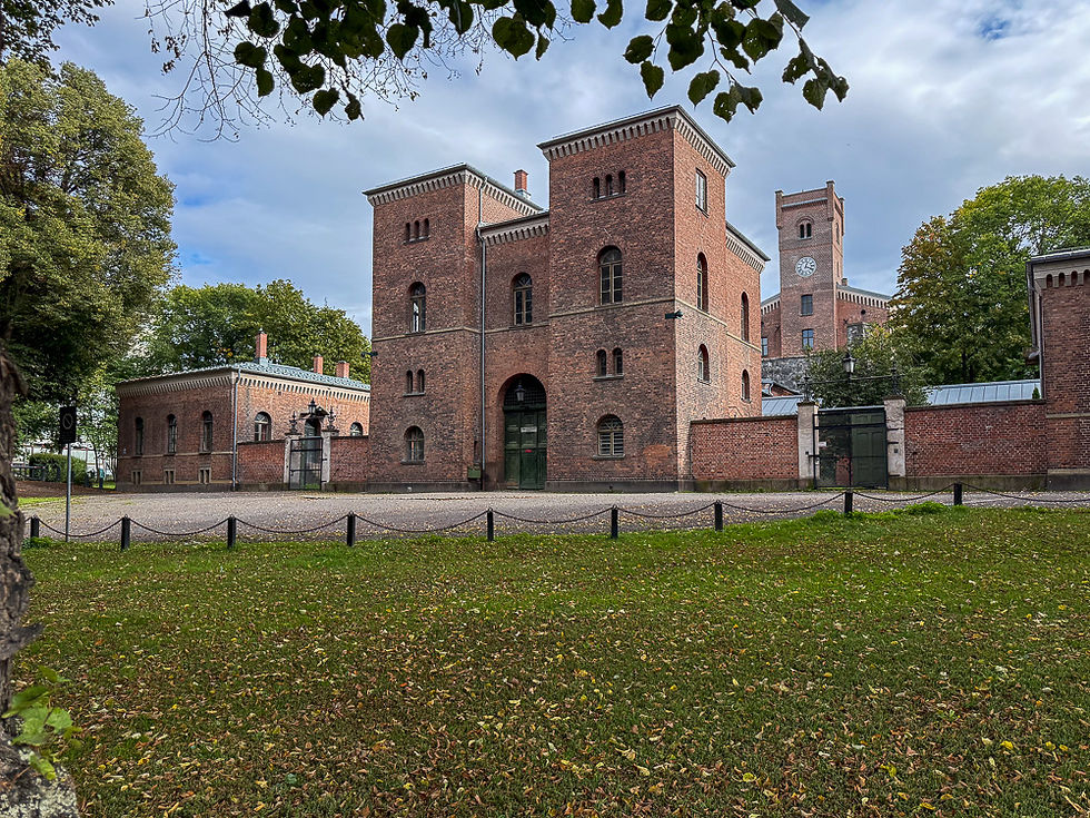
Store firkantede murbygninger i rød teglsteing inngangspartiet til Oslo Botsfengsel i Oslo
Oslo Botsfengsel (popularly called Botsen) was Norway's most important national prison for male prisoners for over 120 years. It was built in the period 1844-1851 and was intended for serving long prison sentences. It was originally built according to the Philadelphia system of solitary confinement. This punishment method was considered so degrading that the sentence was reduced by a third for those serving it. In 1892, the principle of solitary confinement was abolished. The prison was replaced by Ullersmo National Prison in 1970, but was in use as a prison for Oslo until 2017 when it was finally closed. The buildings are today listed. They are currently empty, but the State has decided to sell them, and they can then be used for cultural purposes, hotel operations or similar as long as the conservation provisions are met.

The tour of old Oslo ends with the penitentiary. From there, you return to the starting point in the Medieval Park.


More excursions: www.turideer.com


Excursion of the week: Tour of old Oslo with the Medieval Park and church ruins in Oslo as well as the old districts of Gamlebyen, Vålerenga and Kampen


Suitable for: Everyone


Getting there: There are parking garages in the area, but they are expensive and it would therefore be best to use public transport. It is a short walk from the train station.


Comments


© 2016 by Liv and Geir Stene-Larsen.

  • Facebook
  • Instagram
bottom of page