
Hiking trails at Xirles
- Admin

- Feb 10
- 4 min read
Xirles is a small village in the municipality of Polop de la Marina in the province of Alicante. It is located at the foot of the mountain Monte Ponoig, popularly known as the Sleeping Lion. The village has narrow streets with well-preserved old brick buildings and has just over a hundred inhabitants. In the area around the town, four marked hiking trails have been created, which are described in this article.

Most of the residents of Xirles are retirees - both Spanish and foreign - who have chosen to settle in Xirles because it is a peaceful place in a traditional Spanish mountain village that is also a short distance from the beaches and city life of Benidorm and Altea on the Costa Blanca. The village has only a few dozen houses grouped around picturesque, narrow streets. A suitable excursion could be to start by walking around Xirles a bit, and then walk one of the marked hiking trails.


The four hiking trails start at the same place. Go up the main street that goes left past the parking lot at the entrance to the village. Follow the road straight ahead and left until you see a sign on the wall showing the four local, short trails. None of these trails are long, so you can just try your hand at it. A suggestion might be to take route 1 to Barranc Xirles and then take route 2 La Serreta on the way back so that it becomes a round trip.

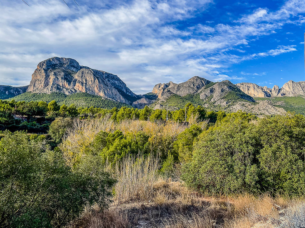


Xirles is also the starting point for several longer hikes. The Ruta Xirles - Gines - Riu Guadalest (village and river route) is nearly 13 km and takes about 3.5 hours. It first goes to the small hamlet of Gines and then via the Riu Guadelest and back via pine forests and medlar fields. The Ruta de la Font de Xirles (source route) is a much shorter hike that goes to the water source that the inhabitants of Xirles have traditionally depended on. There are also longer and more demanding hikes. One of these is the Ruta Xirles - Tossal de Farines - which leads up to the peak Tossal de Farines where you get a nice view of Monte Ponoig and the Mediterranean. Another popular hike is the historic hike from Xirles to Callosa d'en Sarrià which goes along narrow, old country roads through agricultural areas where oranges, lemons and Japanese medlar (nisperos) are grown up to the neighboring town of Callosa d'en Sarrià. The latter is described in a separate post (https://www.turideer.com/post/fottur-fra-xirles-til-callosa).
You can get detailed maps for these and a number of other hiking routes by visiting this website from Polop municipality: Rutas senderistas - Polop de la Marina
More excursions: www.turideer.com
Excursion of the week: Hiking trails at Xirles
Getting there: Xirles is located very close to Polop. It can be difficult to find, so it is best to use Google Maps. Type in Xirles and you will be taken straight to the main entrance to the village. When you arrive at the village, there are several parking spaces. You will find two on the left at the entrance. If you continue straight ahead, you will also find one along the road on the right.


Comments