Sella - The water route - hike in the mountains
- Admin

- Nov 10, 2024
- 3 min read
At the small mountain village of Sella, a few miles inland near Benidorm on the Costa Blanca, there is a marked hiking trail known as the water route - la Ruta de Agua. It runs along the river Ríu L'Arc in the canyon Barranc de L'Arc. This is a round trip of approx. 6 km where you are constantly moving in beautiful nature, often with a view to the mountain of Sella and Sella.

The route starts just before the old bridge over the river Río Sella, which is located just below Sella. Park along the road just before the bridge. Cross over to the other side of the road and continue 50-100 meters in the direction of the coast. There you will find a dirt road marked white and green.


After approx. After 500 metres, you come down to a point where two rivers meet at a large fig tree. Where the river Riu Sella from the left and the river Riu L'Arc from the right flow together, there is a pool. In the summer, there is little water in these rivers, but when it rains, the water flow can be so strong that the hiking route is flooded.


The water from Riu L'Arc has been used for the irrigation system for agriculture and the operation of the mill in the picture below. The mill has its water intake from the roof.

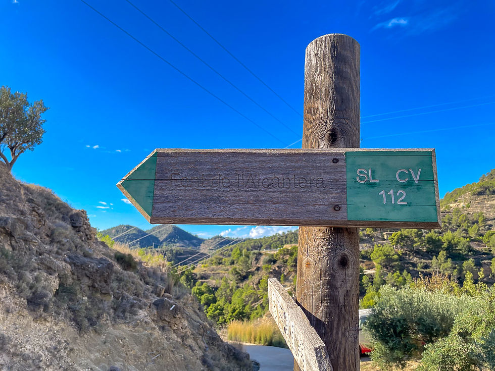
After passing the mill, the hiking trail winds up the hillside. When you approach the top and come to an oncoming road, turn left and follow the sign for SL CV 112 towards the water source Font de L'Alcantera.


At the next junction you should also turn left.

After approx. After 2,600 meters you reach a rest area with tables and benches. Down to the left is a water source called Font de L'Alcàntera. Locals collect water there, and there you can fill your water bottle with clean spring water.


At the rest area there is a small library where you can take a book if you wish - or leave a book you have read yourself. Most are in Spanish.

After this, the hiking trail descends towards the bottom of the gorge where there is a fork in the road. Unfortunately, the hiking trail is poorly marked here. You should continue straight across the crossing and up the gravel road by the stone wall in the picture below. From there, a path continues upwards past the house El Pont. Follow the white and green markings. As a curiosity, it can be mentioned that in the garden on the right when you come down, a vegetable similar to a potato grows. It is called chayote and is imported from Mexido. Unlike the potato that grows in the ground, this one grows on branches in the air on a climbing plant. It can be boiled or fried and is slightly sweeter than potato.


At the next intersection you have two options. You can follow the white/green marked route SL CV 112 which goes on the road up to the right in the picture below. It is the long loop, and it is approx. 6.3 km. Or you can continue straight ahead on the short loop of 5.6 km which is marked yellow and white.

If you go straight ahead, just follow the road until you get down to Sella and the main road where you have parked the car. If you go to the right, you must turn left when you have reached the foot of the mountain to get down to Sella. This stretch has a relatively steep climb both up and down again.
More excursions: www.turideer.com
Excursion of the week: Hike in the mountains on the water route at Sella - la Ruta de Agua.
Suitable for: This is an easy tour suitable for everyone. The route mostly follows a dirt road, but a short distance goes on a slightly stony path.
Duration: The longest route of 6.3 km is estimated to take 2 hours and 45 minutes. The short route is 700 meters shorter and takes approx. 2 1/2 hours.
Getting there: Enter Sella in Google Maps. Alternatively: Take the exit to the center of Villajoyosa from the N-332 or AP-7. Then follow the signs for Sella on the CV-770 until you reach Sella. Park along the roadside on the left just before the old bridge just before you reach Sella.


Thank you! How far is this hike from CALPE?