
Cima del Menajador - Parque Natural del Carrascal de la Fuente Roja in Alcoy - hiking in the mountains
- Admin

- Dec 19, 2025
- 6 min read
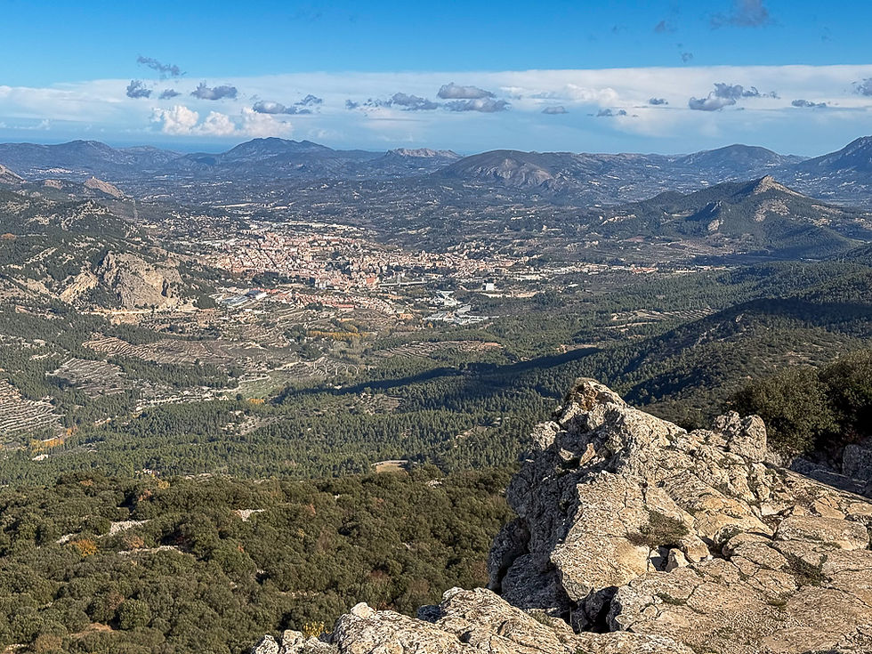
Ten kilometers from Alcoy in the north of the province of Alicante lies the Parque Natural del Carrascal de la Fuente Rojo nature reserve. There are several hiking trails in this area. One of the most popular goes to the top of El Menejador, which rises 1,356 meters above sea level. From there you can see the valley through which the Polop river flows, with the Sierra de Mariola mountain range on the other side and the city of Alcoy at the bottom of the valley to the east. You can also often see griffon vultures circling the mountain. The nature reserve has one of the best preserved oak forests in the Valencia region.

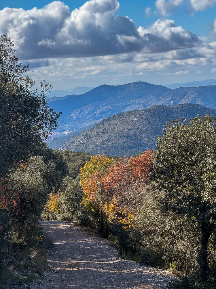
The forest you see in the photo above, taken from the summit of Menejador, is of the holm oak (Carrasca) type. It is a hardy oak species that tolerates the climate well. The oak forest is part of a 2,298-hectare nature reserve located between the municipalities of Alcoy and Ibi. The nature reserve was created in 1987. Most of the hike goes through this forest.

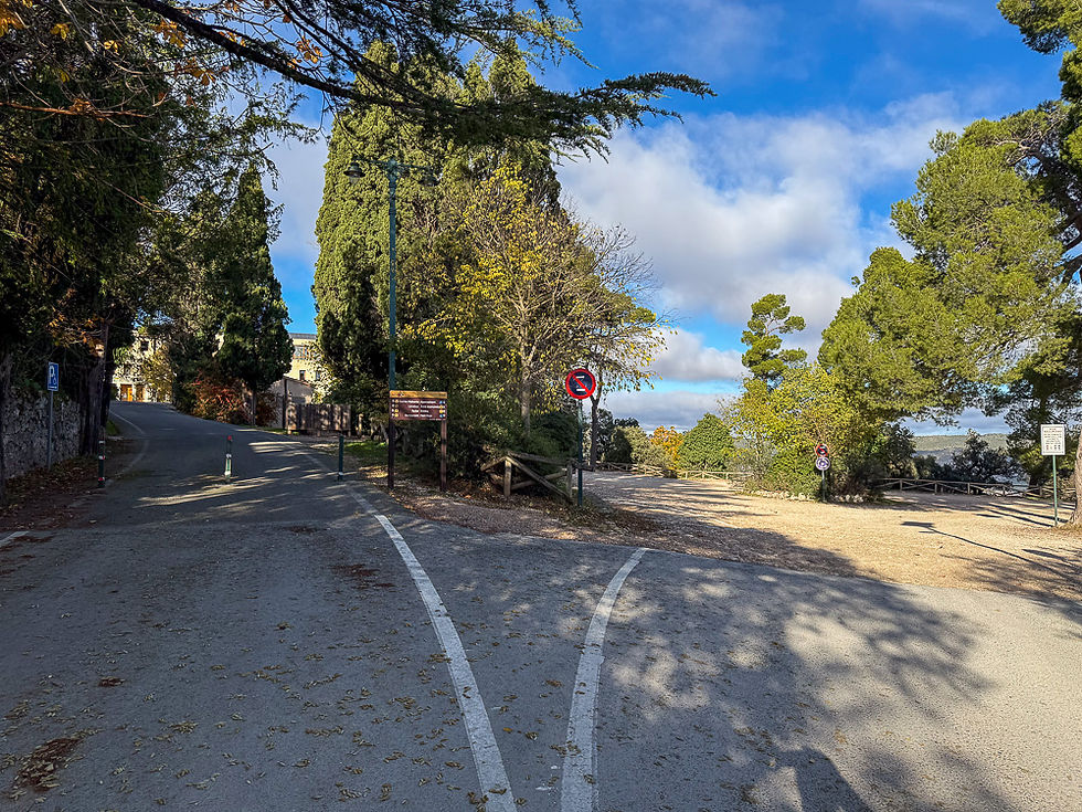
The route starts at the Santuari de Font Roja, which is an old chapel with an attached hotel wing. There is a special reason why the chapel is located exactly where it is. In August 1653, a group of religious people found a white lily flower on the site where the building stands today. They thought it was so special that they wanted to dig it up and take it with them. But when they saw the root, they noticed that it resembled the Virgin Mary. This caused a great stir, and all the other religious people who saw it later agreed that it resembled her. When they discovered that the same was true of other flowers of the same type in the area, they gave it the name Madonna lily. They perceived this as a miracle and decided to build a chapel on the exact spot where the first plant was found. Font Roja and the chapel have been a destination for pilgrimages for hundreds of years.
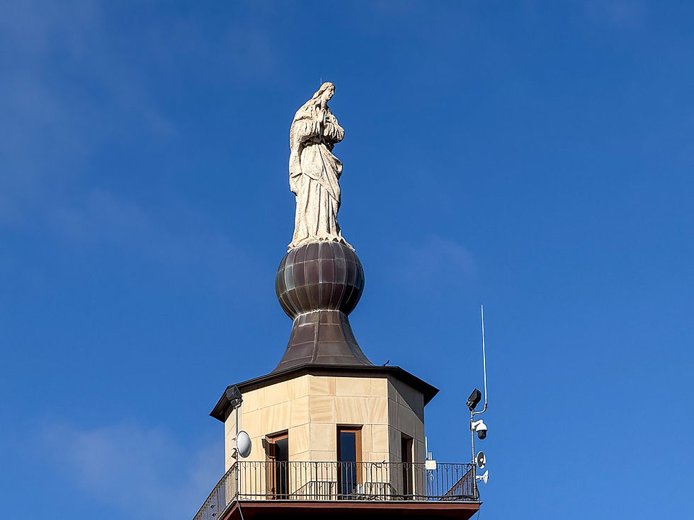
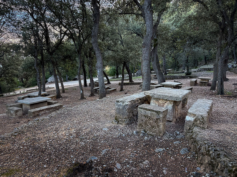
The chapel was consecrated on August 21, 1663. In 1720 it was renovated and a wing with accommodation was added, but due to decay, everything eventually had to be demolished, and in 1886 work began on creating a new chapel. The building we see today was consecrated on June 14, 1891, and a road was also made to it at that time. The hotel wing was built in the 1920s over the ruins of the old hotel and was long used as a recreation area for the wealthy in Alcoy and the surrounding area. Today the hotel is an information center for the nature reserve. Arrangements have been made for visitors to use the area. There is a large parking lot and a nice recreation area with stone benches and tables under shady trees nearby, and a separate building with toilets has been set up.
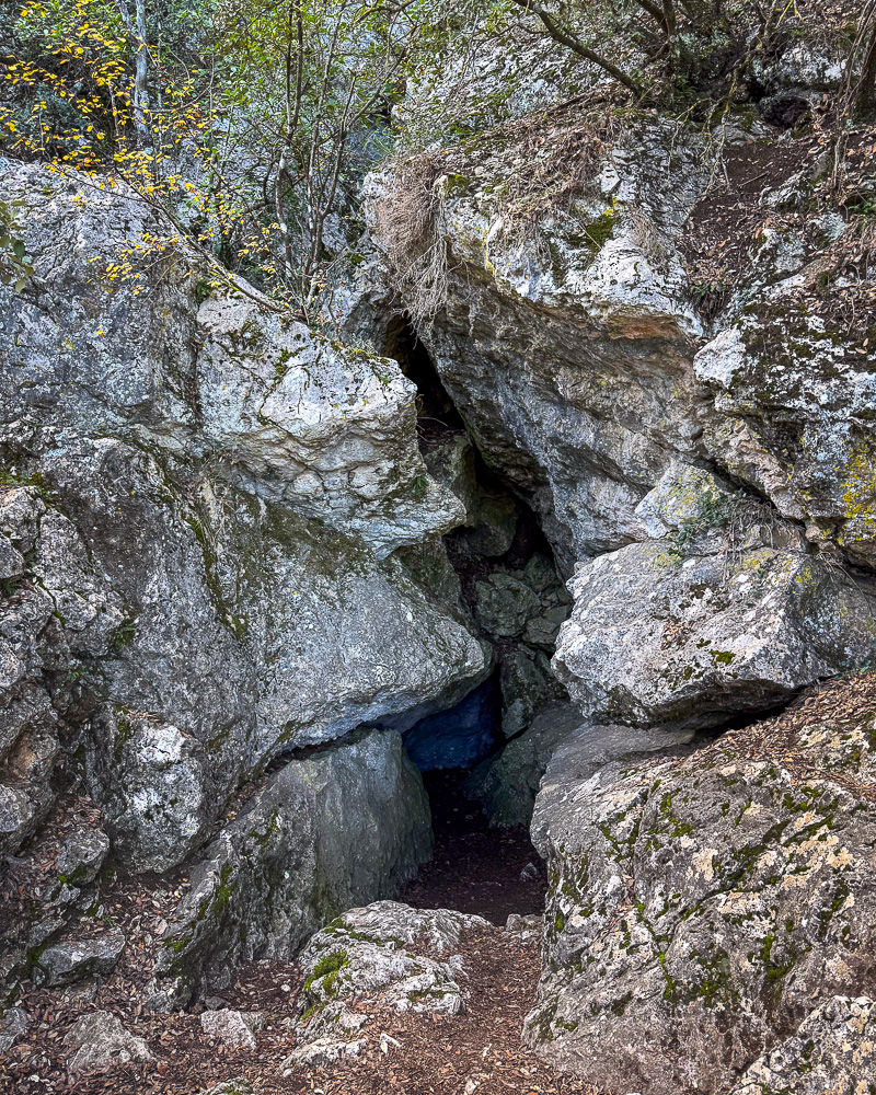
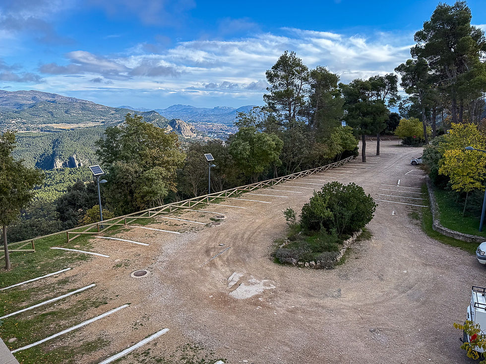
There are several signposted hiking trails from Santuari de Font Rojo. At the start, they all follow the same path. The route described in this post goes to the top of the el Menejador mountain. If you stand at the far end of the large terrace by the hotel wing and look up at the mountain behind, you can see a small yellow house on the top. That's where we're going, but to get there, you first have to walk a bit to the right along the side of the mountain before the slope allows you to go up to the top. There are two routes you can follow. The fastest, but also the steepest, goes on a path that is mostly made of steps. The most pleasant, but also the longest, goes on a driveable road with gravel and concrete pavement all the way to the top. There are three attractions along the way. One - cova Gelada - is only 300 meters away and is a small cave that holds up well to the winter cold. The second - Pla de la Mina - which is only 200 meters further, is a preserved lime kiln from the time when lime was extracted here. There is also a reconstructed kiln for making charcoal and a viewpoint. The third one you almost have to climb to the top to see, and it is one of the six preserved ice pits that were used to produce ice in the winter.


More excursions: www.turideer.com
Excursion of the week: To Cima del Menajador - Parque Natural del Carrascal de la Fuente Roja in Alcoy - mountain hike
Suitable for: Anyone in normal physical condition. It is a long and relatively difficult climb that can be tiring, but there are no dangerous sections, and the road is driveable by car all the way to the top for personnel at the nature reserve.
Length: The hike is 6 km each way, a total of 12 km. It takes about 3-4 hours to walk with a few breaks along the way. The parking lot is located at 1000 meters above sea level, while the summit is at 1356 meters above sea level. You will therefore walk about 356 meters in altitude.
How to get there: Type "Santuari de la Font Roja" into Google Maps. This will take you to the parking lot by the old chapel where the hike starts. The routes are well signposted. Alternatively, you can take the A7 from Alicante towards Alcoy. When you get to Alcoy, take the exit towards Alcoy and then follow the N-340 at the first roundabout. After this, you can follow the signs for Font Roja or Santuari Font Roja until you reach the parking lot. There is a section of steep and narrow road with hairpin bends, but it is well paved the whole way.


Comments